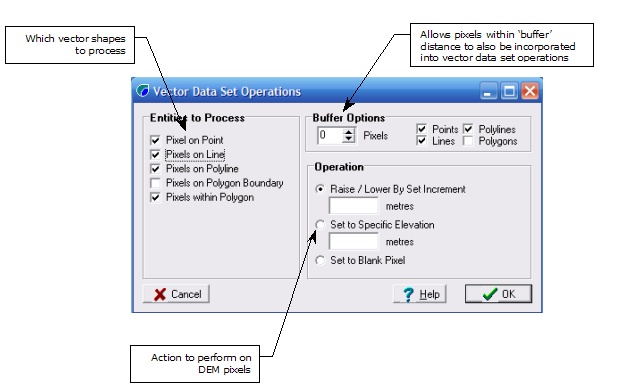
The vector data set operations menu option will allow changes to a DEM to be made based on a GIS file.

For example, if certain features such as road crests are not picked up in a course DEM then they can be manually input into the DEM using the Vector Data Set operations by using the Pixels on Polyline checkbox and Raise by 2m (for example). The breaching algorithm can then be run to breach the road alignments at their lowest point to determine road overtopping points during a flood.