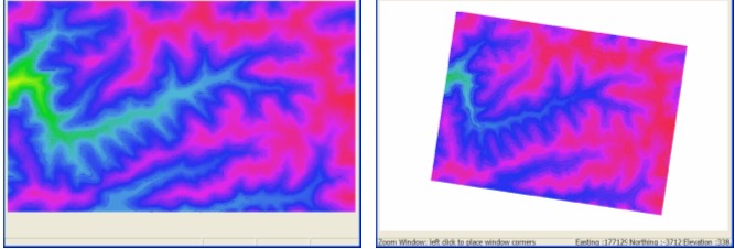
There are two main options for incorporating an external DEM into a CatchmentSIM project, it can be imported or sampled. Importing a DEM will simply convert an external DEM into a CatchmentSIM DEM with the same pixel size whereas sampling a DEM will use an external DEM to read the elevation of the pixel centre coordinates of blank pixels in a CatchmentSIM DEM. This allows a user to setup a DEM of whatever projection, resolution and extents they wish and then populate the pixel elevation based on an external surface (the external DEM). This is particularly useful when DEMs are in geographic coordinates (lat/long) and you want to undertake a CatchmentSIM analysis in a projected coordinate system. Figure 36 illustrates how a lat/long DEM is sampled in a UTM projection.

Figure 36 : Re-projection of a lat/long DEM into a projected coordinate system
To reproject a DEM, setup a project with the desired projection (CatchmentSIM Drop Down >> New Project), setup the DEM with the desired boundaries and resolution (Create DEM >> Setup Blank DEM) and then populate the DEM pixel elevations with the external DEM (Create DEM >> Raster DEM). You will be prompted to select the projection of the external DEM or lat/long if appropriate. CatchmentSIM will then reproject the DEM accordingly. When a DEM type is selected where the projection is known (such as SRTM data which is lat/long) then CatchmentSIM will automatically recognise the correct projection.