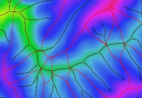
The Preview Stream Directions menu option will visually display the direction of downstream flow along streams based on the underlying DEM (refer image below). The stream directions will only be displayed along imported GIS stream lines. Therefore, if no GIS streams are available it will be necessary to generate a vector stream network in CatchmentSIM (Flow Mapping >> Generate Streams), export the streams as a GIS layer (Export >> Export to GIS) and import the streams back into CatchmentSIM using GIS >> Streams.
The stream direction arrow heads are a temporary layer only. That is, refreshing or otherwise modifying the CatchmentSIM display window will cause the flow direction arrows to disappear.
This display is designed to aid in preparation to ensure the enforce drainage direction algorithm can operate successfully. If the displayed drainage directions are not correct then the terrain underneath the stream segment may need to be modified by ensuring the pixel elevation under the downstream end is lower than that under the upstream end.
