This is a more advanced tutorial demonstrating how Storm Injector can be used to undertake a spatially varying IFD analysis for ARR 2016 using WBNM.
For this tutorial, you can use the WBNM ENG version of WBNM which can be downloaded from here. Download and then link the wbnm_eng.exe file in the WBNM Settings >> Engine field in the Settings tab.
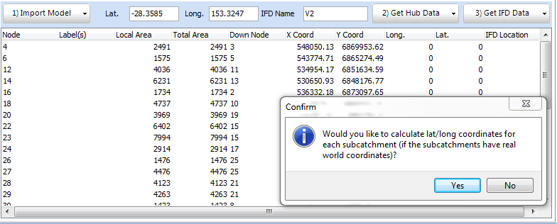
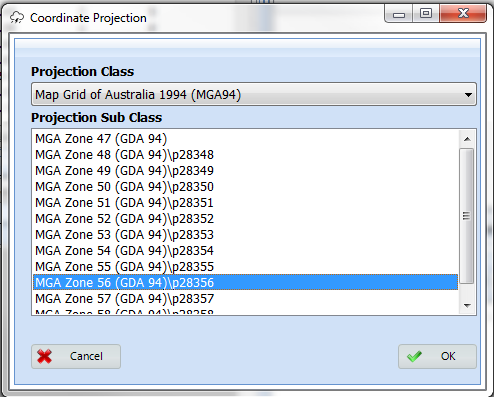
1.Import the model 'tweed.wbn' using '1) Import Model >> import model >> WBNM'. When you are prompted to calculate lat/long coordinates, click yes since this file is in MGA Zone 56 coordinates. Once you have selected MGA Zone 56 for the projection list, you should see that the Lat. and Long. columns have been filled. The Lat and Long fields at the top of the panel have also been filled with the average Longitude and Latitude of the model for downloading the ARR Data Hub. The total area of the model has also been populated in the the Area (km2) field in the Areal Reduction Factors box.
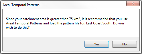
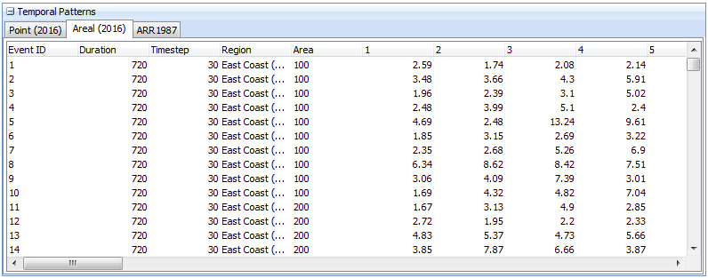
2.This model is over 75km2, so it is recommended to use Areal Temporal Patterns. Since these can not be automatically downloaded from the ARR Data Hub, you may wish to manually download them or use the 'Areal_ECsouth_Increments.csv' distributed with the software.
3.Click '2) Get Data Hub' button. After clicking 'Ingest Data' you will be prompted to switch to Areal Temporal Patterns. Click Yes and then select the 'Areal_ECsouth_Increments.csv' file from the previous step.
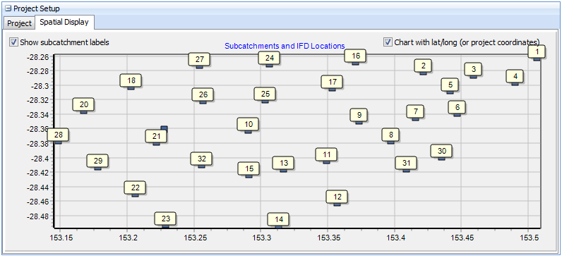
4.We want to download IFD dataset for several locations throughout the model. If you look at the Spatial Display tab, an indicative map of subcatchment locations will be shown. In this example, we will download IFD data for locations at the centre of subcatchmnets 29, 10 and 7.
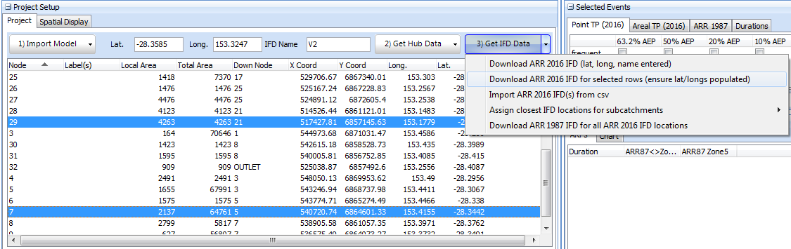
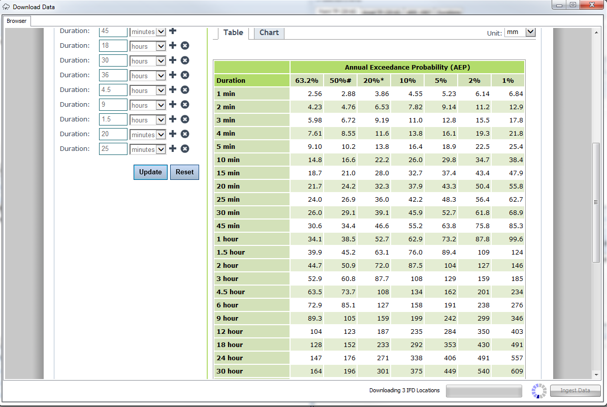
5.Select the rows corresponding to these subcatchments on the Project tab by using the CTRL key. Then click '3) Get IFD Data >> Download ARR 2016 IFD Data for selected rows'. Storm Injector will go through the process of downloading IFD data for the 3 locations.
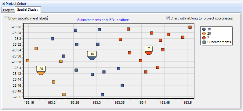
6.To assign subcatchments their closest IFD location, select 3) Get IFD Data >> Assign closest IFD locations for subcatchments >> using lat/long'. At this stage, if you examine the IFD location column and the Spatial Display tab, you should see that each subcatchment has been assigned the closest IFD location as its IFD location.
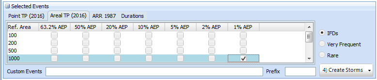
7.To generate the storms for the relevant Areal Temporal Patterns, check the 1% AEP checkbox on the Areal TP (2016) tab.
8.Next click '4) Create Storms'. The ARFs, Burst Losses, Routing Increments and Storms will be calculated. A warning will be displayed informing that median preburst values have exceeded the global initial loss resulting in initial loss values of 0 for many storms.

9.Click  and select the same file tweed.wbn which is located in the WBNM folder relative to where you have unzipped the software on your PC.
10.Ensure the path to the WBNM engine file is correctly set in the settings.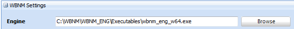
11.Click 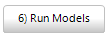 . You should see that all the models are run in sequence with up to 4 models running at once. You can switch to hidden window mode to remove the popup window effect.
12.Once the model running is complete (this should take less than one minute), click 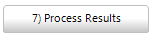 to analyse the results. From this point you can refine your subcatchments of interest, chart box and whisker plots, chart hydrographs and analyse which temporal patterns are most often adopted.
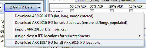
13.As an advanced exercise, you can compare the results to ARR 1987. This can be simply done by downloading the ARR 1987 IFD information using 3) Get IFD Data >> Download ARR 1987 IFD for all ARR 2016 IFD locations.

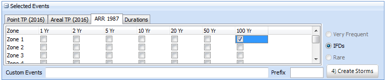
14. Select the Zone 1 checkbox in the ARR 1987 tab of the Selected Events panel and click Create Storms. You should now see that ARR 1987 storms are also in the grid at the bottom below the ARR 2016 Areal storms.
15.After running the storms (if you don't wish to re-run the Areal TP storms, you can just group select the ARR 1987 storms, right click and run all selected). Click '7) Process Results' You should now be able to compare ARR 1987 vs ARR 2016 results.


This tutorial is intended to be a quick demonstration of spatially varying rainfall depths in Storm Injector . It is not intended to reflect best practice in hydrologic modelling. Furthermore, the tweed wbn model is unverified and uncalibrated and intended for demonstration purposes only.
Please note that the sample file distributed with Storm Injector are offered for demonstration purposes only.