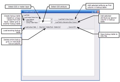
The Create Lookup Table form is used to create lookup tables based on unique values from a GIS layer, raster grid or another lookup table. The resulting lookup table would typically be used with the Raster Calculator to assign additional parameter values based on a GIS or raster layer attribute. The Create Lookup Table form is shown below.
To create a lookup table, you must first select a GIS or raster gird layer attribute or a column from another lookup table by using the radio button and drop down boxes on the top left of the form. Once you click the "Load Field To New Column" button, all unique values from the selected GIS layer, raster layer or lookup table column will be added as a new column on the left hand side of the main table. To remove a row or column at any stage, select the row or column and click the "Delete Row" or "Delete Column" button.
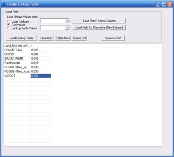
Next 'lookup' values must be assigned to each unique category. If you would like to specify values that are independent of any other layers or lookup tables (e.g., if you would like to assign Manning's 'n' roughness values to land use categories), click the "Load Field as Alternative (New Column)" button but ensure that no layers are selected in either of the drop down boxes. This will add a new blank column. The manning's 'n' roughness values can then be input next to each land use category (refer below).
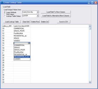
If you would like to assign 'lookup' values based on unique values contained in another GIS layer, grid layer or lookup table, select the desired layer using the radio buttons and drop down boxes near the top left of the form. Then click the "Load Field as Alternative (New Column)" button. This will add a new column to the table, however, no values will be displayed. To select which unique value to add to each row of the table click any cell in the second column of the table. A drop down box will appear enabling you to make your selection, as shown below:
To save the CSV file, click the "Save to CSV File" button.


