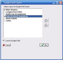
The Export to Google Earth menu option allows selected vector layers to be exported from CatchmentSIM and displayed in Google Earth (the free version of Google Earth can be downloaded from http://earth.google.com/). After selecting this menu item, the user will be asked to specify which vector data layers are to be exported from CatchmentSIM (refer below).
The user will then be prompted to specify the name of a Google Earth KML file. CatchmentSIM exports the selected vector layers into the KML file before launching Google Earth.
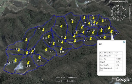
If the 'Launch Google Earth' check box is selected, Google Earth will be automatically opened and the KML file containing the previously selected CatchmentSIM layers will be displayed (refer below). Please note that Google Earth requires an internet connection in order to function.
A 'pushpin' will be displayed at the centroid of each subcatchment. The 'pushpin' can be selected and the associated properties of the subcatchment will be displayed.
Please note that if you wish to use a Google Earth image you must preserve the Google copyright and associated attributes (this includes the Google logo). Please be aware that you cannot sell the image to others, provide the image as part of a service, or use them in a commercial product such as a book or TV show without first getting a rights clearance from Google.

